

MontenegroAlbaniaKosovo
8 days · Hiking
Peaks of the Balkans Trek: 8 Days in the Accursed Mountains
▲▲▲▲▲Challenging
Travel style · Traveller
The Peaks of the Balkans is a 192 km hiking loop through the mountains where Albania, Kosovo and Montenegro meet. Here are its 10 stages, permits, guesthouses and best months, plus our 8-day guided trek on part of the trail. Ask us about a longer or self-guided version.
About this collection
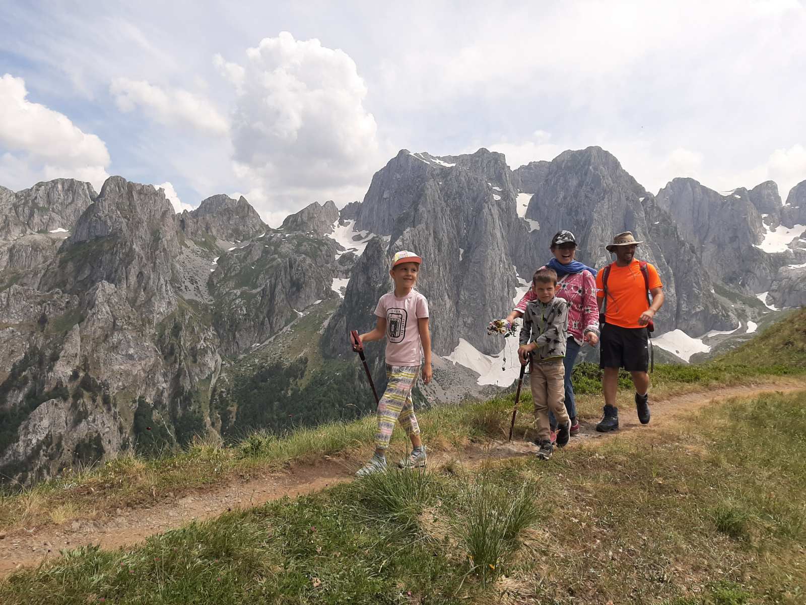
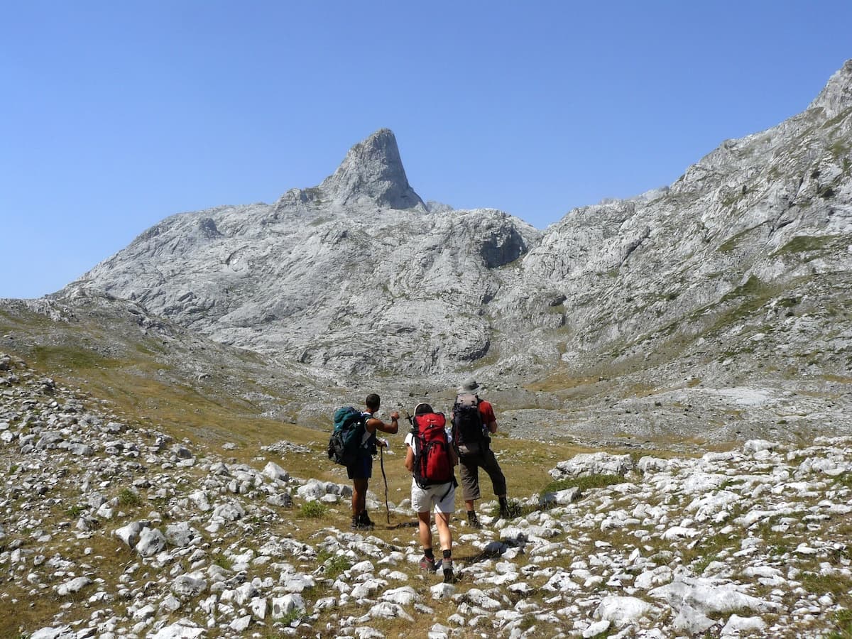
The Peaks of the Balkans is a waymarked hiking trail of about 192 km. It loops through the Accursed Mountains, also called Prokletije, across Albania, Kosovo and Montenegro. Hikers usually walk it in 10 stages. Most nights you sleep in a family-run guesthouse in a mountain village or shepherd settlement.
The trail suits fit walkers who are sure-footed on steep, rough paths. Expect seven to eight hours on your feet on most days. Many days include around 1,000 m of climbing.
Our 8-day guided trek walks part of the route. The trip starts in Podgorica and heads to Peja and the Rugova valley in Kosovo. From there you cross the Jelenak Pass and the border ridge into Montenegro. From the Grebaje valley you walk over Peja Pass to Theth, and on to Valbona in Albania. The trip ends with the Lake Koman ferry and a night at Lake Skadar. A local English-speaking guide walks with you, and your luggage moves between stays. Our team is based in Podgorica, and we walk or ride every route we sell. Want the full loop, extra rest days or a self-guided version? Tell us, and we will look at what fits your dates.
Our journeys
1 journey that matches — planned by our team in Podgorica.
Build your own trip →8 days · Hiking
Even better than we expected! Beautiful countries with warm and welcoming people. Both Angelica and Drazen were absolutely fantastic to work with. They both covered ever fine detail of the trip and Drazen was there to take calls even into the evening. Bikes were great also. Got a flat and they fixed it for us. The accommodations were always wonderful with some stays in historical fortresses. A trip of a lifetime that we will always have fond memories of.
Good to know
The Peaks of the Balkans is a long-distance hiking loop of about 192 km. It follows shepherd paths and old mountain tracks, and crosses the borders between Albania, Kosovo and Montenegro on high passes. The route runs between roughly 670 m and 2,300 m above sea level.
GIZ, Germany's development agency, set up the trail with local partners in the three countries. The aim was to help people in remote mountain villages earn a living from tourism. Today, family-run guesthouses wait at the end of almost every stage. On the Montenegrin side, many have opened since 2018.
Most people walk the loop in 10 stages over 10 to 12 days. Because it is a circle, you can start in any of the three countries. The official stage list starts in Theth. Common gateway towns are Shkodra in Albania, Plav in Montenegro and Peja in Kosovo.
The whole trail runs through the Accursed Mountains. Montenegro protects its side as Prokletije National Park. Kosovo protects its side as Bjeshkët e Nemuna National Park. In Albania the trail links the Theth and Valbona valleys.
Starting from Theth in Albania, the official stages run in this order. Theth to Valbona crosses the Valbona Pass. Valbona to Çerem and Çerem to Doberdol lead to Doberdol, a summer pasture settlement at about 1,750 m. Doberdol to Milishevc crosses into Kosovo. Milishevc to Reka e Allagës ends in a shepherd village near the Rugova valley and the town of Peja.
Reka e Allagës to Kuçishtë passes the village of Drelaj in the Rugova mountains. Kuçishtë to Babino Polje passes small glacial lakes and climbs over the Jelenak Pass, at more than 2,200 m. It is one of the highest points on the trail. The path then crosses the ridge into Montenegro. Babino Polje to Plav passes Hrid Lake. Plav to Vusanje runs to a village near Gusinje. The last stage, Vusanje to Theth, climbs to Peja Pass and drops steeply into the Theth valley.
You can shorten the loop, skip a stage by road or add a summit. Hajla (2,403 m) rises above Rugova. Gjeravica, Kosovo's highest peak at 2,656 m, stands close to the trail.
Most stages are 13 to 23 km long, with seven to eight hours of walking. The longest can take up to ten. Many days include around 1,000 m of climbing and a similar descent. Over the full loop, that adds up to roughly 9,800 m of ascent.
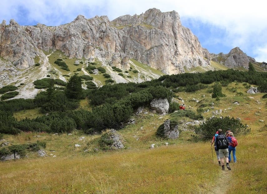
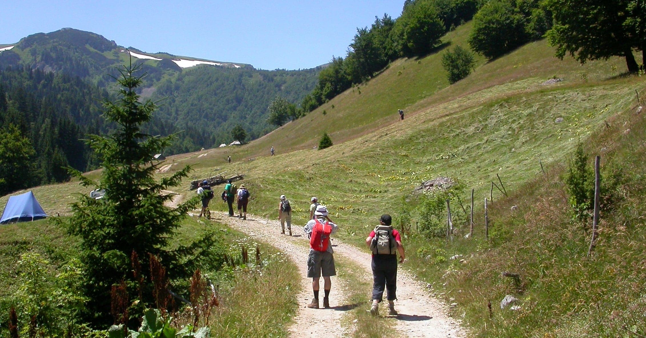
A typical day starts after an early breakfast at the guesthouse. You carry a packed lunch, water and warm layers. Paths climb through forest to open pasture and rocky passes, then drop to the next village. On the way you pass shepherd huts, summer settlements and, in Albania, old concrete bunkers.
The waymarks change style between the three countries. Look for red and white stripes or a red ring with a white centre. Marks are thin at some junctions, so carry an offline map or GPX track. Some settlements, such as Doberdol, have no phone signal.
Bring enough cash for the whole walk. On the route, you find ATMs only in Plav and Peja. Montenegro and Kosovo use the euro, and Albania uses the lek. In the karst areas, some springs can run dry by August, so fill your bottle in the villages.
You sleep in family-run guesthouses. Almost every stage ends in a village or a seasonal shepherd settlement with beds. Most guesthouses offer half or full board: dinner, breakfast and a packed lunch for the trail.
Standards vary along the route. Theth and Valbona have established guesthouses, some with en-suite double rooms. In summer settlements such as Doberdol, you may sleep in a simple hut on a mattress.
Book ahead in July and August, especially in Theth, Valbona and the Rugova valley. The next village with beds is usually a full day's walk away.
On our 8-day trek you stay in a double or twin room, with breakfast every day. Lunch and dinner are not included. In Theth we stay at the oldest guesthouse in the village.
The main season runs from mid-June to mid-September. In those months the weather is more settled and the guesthouses are open. Before mid-June, expect snow above about 1,800 m, especially on north-facing slopes. After mid-September, nights turn colder and long spells of rain become more likely.
July and August are the warmest and busiest months. The Theth to Valbona stage gets especially busy. A sensor on that path counted more than 43,000 hikers between July and November 2024, according to GIZ.
For quieter paths, aim for late June or the first half of September. You still get open passes, with fewer people on the famous stretches.
Mountain weather changes fast in any month. Summer afternoons can bring thunderstorms, so start early on the long pass days. Our month-by-month season guide covers conditions in the Montenegrin mountains in more detail.
You need a permit for every green-border crossing. That means any crossing on foot away from an official checkpoint. The full loop crosses three borders: Albania to Kosovo, Kosovo to Montenegro, and Montenegro to Albania.
The border police of each country handle the permits. You apply in advance with your passport details, your route and your dates. Start at least two weeks before your trip. On the trail, carry your passport and printed copies of every permit.
Crossing without a permit can mean a fine and detention. The forms and steps differ by country, and they change from time to time. Check the current rules for each crossing before you fix your dates.
Border crossing permits are not included in our 8-day trek. When you enquire, ask us what you need to arrange for your crossing dates.
The Peaks of the Balkans is a walking route. It asks for fitness and sure footing more than technical skill. The challenge is the length of the days, the steep climbs and descents, and loose ground near the passes. Good boots, broken in before you arrive, matter a lot.
Theth to Valbona is the best-known stage. It is about 14 to 18 km, depending on where you start and finish. Allow six to eight hours. You climb from the Theth valley through forest to the Valbona Pass, close to 1,800 m. Then you descend into the Valbona valley. You can also walk it on its own as a one-day crossing.
The stage into Theth from Montenegro is harder on the knees. After Peja Pass, the path drops about 900 m in one steep descent.
We grade our 8-day trek as challenging. The longest day, Grebaje to Theth, covers 21 km with up to eight hours of walking. If a trip is harder than you want, we will say so. We can then suggest a gentler hiking trip instead.
Podgorica airport in Montenegro is a practical arrival point for the trail. From there, the main gateways are Shkodra for Theth and Valbona, Plav in Montenegro, and Peja in Kosovo.
For Theth, drive to Shkodra in northern Albania, about 75 minutes from Podgorica. From Shkodra, a mountain road climbs to Theth in about three hours. For Valbona, drive from Shkodra to Koman and take the ferry across Lake Koman. The boat ride takes two to two and a half hours. From Fierza, at the far end of the lake, a road continues to Valbona.
For Plav, buses from Podgorica take just under four hours. For Peja in Kosovo, the drive from Podgorica takes four to five hours. Pristina airport is about 80 km from Peja.
Our guide to flights to Montenegro covers Podgorica airport and when to book. On our 8-day trek, transfers are included as set out in the itinerary.
You can walk the trail on your own. You plan the stages, book each guesthouse, apply for the permits and usually carry all your gear. Where the waymarks thin out, you find your own way. Experienced hikers who navigate well do it this way every summer.
An operator takes most of that work off your hands. On our 8-day guided trek, a local English-speaking guide leads the walking days. Your luggage moves between overnight stops, so you walk with a day pack. Your rooms and transfers are booked before you arrive. Our team in Podgorica plans the route with you.
The 8-day trip covers part of the trail. You may want the full 10-stage loop, more rest days or a self-guided version at your own pace. If so, ask us, and we will tell you what works for your dates and fitness. Read how our self-guided trips work, or plan your trip with us.
Tell us roughly when, who's travelling and what kind of pace you like. We'll send back a draft itinerary within 1–2 days.
Plan your trip